


Arctic sea level has been falling by a little over 2mm a year – a movement that sets the region against the global trend of rising waters. A Dutch-UK team made the discovery after analysing radar altimetry data gathered by Europe’s ERS-2 satellite.
It is well known that the world’s oceans do not share a uniform height; but even so, the scientists are somewhat puzzled by their results.
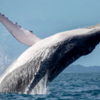
Global sea level is expected to keep on climbing as the Earth’s climate warms.
To find the Arctic out of step, even temporarily, emphasises the great need for more research in the region, the team says.
“We have high confidence in the results; it’s now down to the geophysics community to explain them,” said Dr Remko Scharroo, from consultants Altimetrics LLC, who led the study.
Next year has been designated International Polar Year, and major oceanographic expeditions are planned to take research vessels into the northern region to sample its icy waters.
“This may provide clues as to what is causing the changes we’re seeing,” explained co-researcher Dr Seymour Laxon, from University College London (UCL).
“I think it’s a true statement to say the Arctic Ocean is the least well understood body of water out there.”
The recent trend could be linked to changes in the temperature and salinity (saltiness) of Arctic waters. This would have to be investigated, he said.
Between the cracks
The European Space Agency’s (Esa) ERS-2 satellite has been making observations of the Earth from its 800km-high polar orbit for over 10 years.
Its Radar Altimeter is constantly throwing down pulses of microwave energy at the land and sea. The time taken for these pulses to bounce back gives a measure of surface height.
Determining elevation trends in a large, moving mass such as an ocean is far from straightforward, however. This is especially so in the Arctic where large areas are covered with pack ice for significant periods of the year.
The satellite data, therefore, has to undergo intensive processing to produce meaningful results.
Only that data gathered over open ocean or water surfaces between cracks in the ice can be used – obviously. The data is also corrected to take account of ocean tides, wave heights, air pressure, and atmospheric effects that might bias the signal.
Working through all these sorts of issues, Dr Scharroo and colleagues have now established seasonal and yearly sea-level trends in the Arctic (from 60 to 82 degrees latitude) for the period 1995 to 2003. The analysis reveals an average 2.17mm fall per annum.
It is unique analysis for the Arctic. No comparable satellite dataset for the region exists, said Dr Scharroo
“When you get a result like this you always worry that your processing of the data may have introduced signals that are not real. But we can’t find anything that we’ve done wrong, so that makes us think we have stumbled across something real – and we hope that will excite our colleagues,” he added.
Long series
Taking a global view, ERS-2 still records a sea-level rise.
Its radar altimetry data can be meshed with that gathered by its sister spacecraft ERS-1; Europe’s leading Earth-observing platform, Envisat; the US Navy’s Geosat Follow-On Mission, GFO; and Nasa’s highly accurate Topex-Poseidon and Jason missions.
When this is done, ocean waters are shown to have gone up across the planet by 3.2mm per year for the period 1992 to the present.
This gives Scharroo and colleagues additional confidence. The plan now is to incorporate data from Envisat and ERS-1 to fill out the polar picture.
There is little that can be done at present, however, to address the caveat in satellite altimetry’s view of the Arctic – the “hole” in the data above 82 degrees; no spacecraft flies above this latitude.

Social Profiles