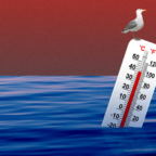
Few consequences of global warming pose as severe a threat to human society as sea-level rise. But scientists have yet to figure out how to predict it.
And not knowing what to expect, policymakers and others are hamstrung in considering how to try to prevent it or prepare for it.
To calculate sea-level rise, the key thing researchers need to understand is the behavior of the major ice sheets that cover Greenland and Antarctica. The disintegration of one would dramatically raise the ocean.
But while computer models now yield an increasingly sophisticated understanding of how a warming atmosphere would behave, such models have yet to fully encapsulate the complex processes that regulate ice sheet behavior.
“The question is: Can we predict sea level? And the answer is no,” said David Holland, who directs New York University’s Center for Atmosphere Ocean Science. Holland, an oceanographer, added that this may mean researchers will just have to watch the oceans to see what happens: “We may observe the change much more than we ever predict it.”
In its executive summary report for policymakers in February, the Intergovernmental Panel on Climate Change, composed of hundreds of leading climate scientists, barely hazarded a guess on sea level, predicting that it would rise between 7.8 inches and two feet by the end of the century.
However, the United Nations-sponsored panel — which operated under the assumption that, by 2100, the Greenland ice sheet would lose some mass but that the Antarctic ice sheet would gain some — did not venture a best estimate or an upper limit for possible sea-level rise.
The panel could agree to say only there is a 50-50 chance that a global temperature increase of between 1.8 and 7.2 degrees Fahrenheit would lead to a partial melting of the ice sheets over a period of several hundred to several thousand years.
Because so much is at stake — a three-foot increase in sea level could turn at least 60 million people into refugees, the World Bank estimates — ice sheet modelers are working furiously to try to unravel the mystery of how these sheets accumulate and lose mass.
Michael Oppenheimer, a Princeton University professor of geosciences and international affairs, does make a prediction: He figures that if the Greenland ice sheet disintegrates, sea level would rise about 23 feet. If the West Antarctic sheet melts, as well, it would add an additional 17 feet or so.
“If either of these ice sheets were to disintegrate, it would destroy coastal civilization as we know it,” Oppenheimer said.
One of the biggest challenges facing researchers is that ice sheets are under “attack from the edges,” in the words of Richard B. Alley, a Pennsylvania State University geosciences professor.
Each sheet amounts to a pile of snow compressed over time into a two-mile thick, continent-spanning sheet of ice, which spreads out under its own weight, Alley said.
Near the coast, the pile develops quick-moving “ice streams,” which flow between slower-moving sections of ice and float out onto the ocean in an “ice shelf.” While recent satellite data have indicated that these ice streams are flowing faster and delivering more water to the oceans, many uncertainties remain.
David Vaughan, a glaciologist with the British Antarctic Survey in Cambridge, said the terrain beneath the ice streams helps determine how they move, but the contours of the land are largely unknown because it is buried so far under the ice.
The streams may run aground on elevated bedrock, slow down as they move past rocky fjord walls or speed up as they move over mud.
“There’s a continent of topography sitting under Antarctica,” Vaughn said. “Everything there has an impact on how the ice sheet flows, and very little of that has been mapped.”


Social Profiles