


But in 2003, Briton Pen Hadow made history by becoming the first person to do just that, and next year he plans to return. However, this time he has more on his mind than just adventure.
I met him at the Royal Geographical Society in London where he told me about his concerns for the Arctic.
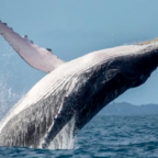
Research shows that for three decades, sea ice cover in the region has been shrinking; and this summer, figures revealed a record withdrawal – the smallest area covered by sea ice since the beginning of the satellite age.
Scientists are now in a race to work out just how long it will be before we see completely ice-free summers in the Arctic.
“I realised one of the biggest environmental questions of our time was how long the North Pole icecap could survive the onslaught of global warming,” said Mr Hadow.
“And the only way to get a more accurate figure… is by doing a direct surface survey; and I find myself in the wonderful and unexpected position of being able to do that.”
Next February, Mr Hadow, along with Ann Daniels and Martin Hartley, will set out on an 2,000km (1,200 miles) trek from Point Barrow, Alaska, to the geographic North Pole; a journey that will take approximately 100 days.
As they walk – and at times swim – across the hostile landscape, they will be towing a sledge carrying a host of scientific instruments.
Mr Hadow said: “I feel like a bit of a donkey to be honest; all I’m really going to be doing is pulling this hugely heavy sledge with this incredibly hi-tech gadgetry which can measure the exact thickness of the icecap.”
See how the Arctic survey will work
Although there is very good data on the extent of Arctic sea ice, the data on thickness is relatively poor. And if scientists are going to make the best forecasts on ice longevity, they need both types of measurement.
To date, most information on thickness has come from submarines.
Professor Peter Wadhams, head of the Polar Ocean Physics Group at the University of Cambridge, said: “The role of submarines has been vital.
“The very first measurements of ice were done from the Nautilus, the American submarine in 1958, and every year since then a submarine, either British or American, has gone to the Arctic.
“In fact, [submarines] have been the only way of mapping how the ice thickness has changed over the last 40 years.”
The vessels use an upward-looking echo sounder to probe the ice thickness, and recent technological advances mean they can even produce 3D maps of the terrain above.
However, there are drawbacks.
The missions are dependent on time aboard military vessels or the use of expensive remotely operated vehicles (Rovs), meaning they are limited to a few weeks, just once or twice a year, in specific locations. In other words, the submarine picture is an incomplete one.
So scientists use another technology to get around this problem, measuring the ice from above using satellites.
Earth from above
Seymour Laxon, a climate physicist at the Centre for Polar Observation and Modelling, University College London, said: “[Satellites] are monitoring the Arctic ice day and night, all throughout the year.”
While satellites are able to measure the area of ice cover directly, probing its thickness is trickier.
Dr Laxon explained: “We can’t measure ice thickness directly, but what we can do is to measure the amount of ice sticking up above the water surface.
“As most people know, nine-tenths of ice is below the water, so you can measure the one-tenth that is above and then use that to estimate how thick the ice is.
“We do that using either a radar or a laser.”
Currently, the European Space Agency’s satellite Envisat makes the bulk of these measurements. However, said Dr Laxon, it was not designed with ice measurements nor the polar regions in mind.

Social Profiles