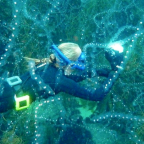
Images from the Great Barrier Reef will soon be coming to Google Maps as the Catlin Seaview Survey maps the world’s largest coral reef system.
“The idea is to test the project on the Great Barrier Reef in 2012, and beyond that to roll the project out globally,” Richard Vevers, founder of Underwater Earth and director for the project.
The project aims to educate the public about the marine ecosystem which has many puzzles for scientists and threatened by global warming.
The Catlin Seaview Survey aims to carry out a comprehensive survey on the health of the reef and educate the public about the importance of the marine ecosystem.
“Our mission is to reveal our oceans to the world and we want to go across iconic locations all over the world...
Read More


Social Profiles